

The use of remote sensing will be a boon for farmers
Dr. Khalifa Mohammed Alkindi
UNESCO Chair on Aflaj Studies
Remote sensing is a geospatial technology that collects and analyzes electromagnetic (EM) radiation emitted and reflected by the Earth's terrestrial, atmospheric, and aquatic ecosystems in order to detect and monitor the physical characteristics of an area without making physical contact. This data collection method typically employs aircraft- and satellite-based sensor technologies classified as either passive or active sensors. Passive sensors gather radiation that is reflected or emitted by an item or the surrounding area in response to external stimuli. Reflected sunlight is the most prevalent radiation source observed by passive remote sensing. Charge-coupled devices, film photography, radiometers, and infrared are all examples of passive remote sensors. Active sensors acquire data using internal stimuli, producing energy to scan things and spaces, after which a sensor detects the energy reflected by the target. Active remote sensing techniques like RADAR and LiDAR measure the time delay between emission and return to determine an object's location, direction, and speed. The collected remote sensing data is subsequently processed and analyzed using remote sensing hardware and software, which is accessible in both private and open-source applications.
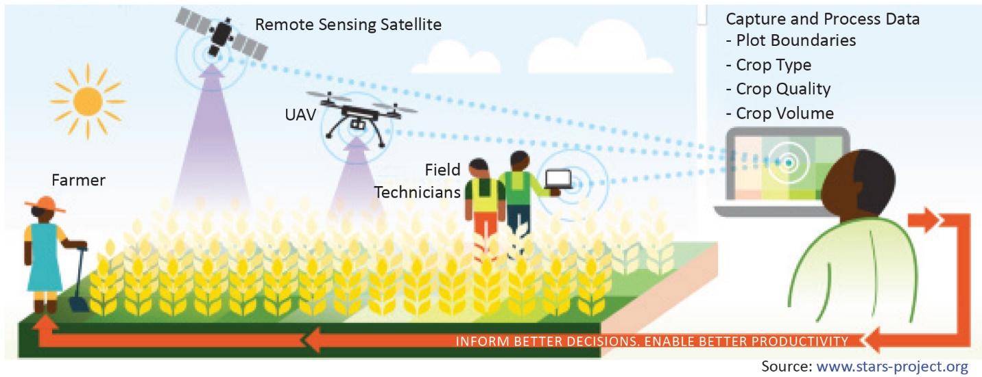
Remote sensing can provide useful information for many crop management decisions, including the detection of nutrient deficiencies, excesses or deficiencies of soil water, damage caused by insects, weeds, or diseases, and the magnitude of these factors in various portions of fields. Thus, widening the use of remote sensing facilities will be a boon for the Sultanate’s agriculture sectors. Remote sensing data can be used as mapping tools to classify crops and examine their health and viability, monitor farming practices, and measure soil moisture across wide area instead of at discrete point locations inherent with ground measurement. This will boost our agricultural sector’s growth and help our farmers. Based on these spatial differences, variables rate inputs such as fertilizers or pesticides can be made. Remote sensing can be used to establish sub-field management zones for variable rate applications, providing a less expansive and finer resolution option than grid sampling. The technologist added that farmers' potential for profitable use of remote sensing is less frequently studied. Nowadays, worldwide remote sensing is a powerful technology because it has led the method for the growth of hyperspectral and multispectral sensors and the application of spectral data. Hyperspectral data is a relatively new technology used to discover and identify precise agricultural, mineral exploration, urban investigation, water stress, etc. It can be useful for monitoring and mapping water stress, detecting plant pests and diseases, detecting the hydrocarbon, mapping and monitoring crop quality and growth, wetland, water quality, and phosphorus and nitrogen deficiencies in corn.
There are several remote sensing centers in GGC countries. The first centre of remote sensing was established by the Institute of Space Research at King Abdulaiziz for science and technology in Saudi Arabia. It provides remote sensing imagery and data for the public and private sectors. The second center of remote sensing in the United Arab Emirates operates by Dubai Space Imaging. It sells information products and services, as well as imagery, and will provide training in imagery analysis and GIS tools applications. In the Sultanate, there are only a few remote sensing documentations available for the scientific community.
Collecting data with remote sensing will help Omani entomologists, biologists, agriculturists to become leaders in the advanced analytical stream. Extensive and exhaustive computational experiments will be made to produce a high-quality, efficient, and easy-to-use solver package for engineers, statisticians, entomologists, biologists, and other scientists.

